









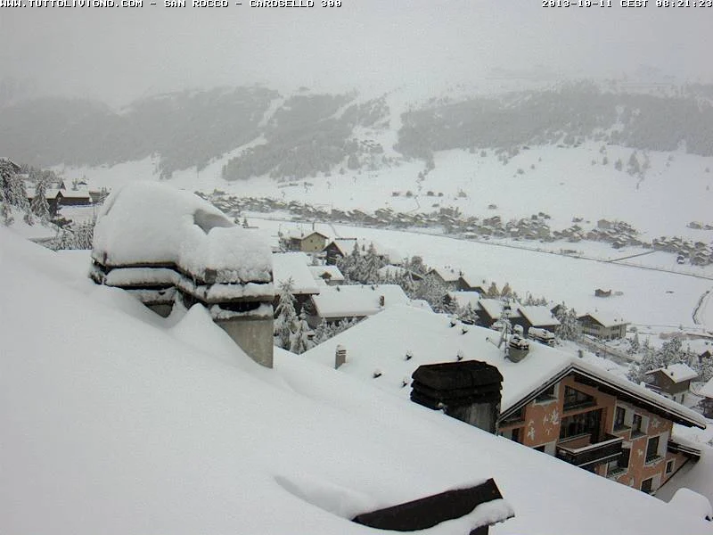
The first white awakening for the Alps: this morning, scores of ski resorts woke up under a pristine white blanket of snow on a rather unusual day, given that the calendar reads October 11.
Forecasts were spot on, you might say, as the “Arctic Drop” arrived right on cue last night, bringing the first snowfalls to high altitude before moving lower down into the valleys to deliver the first snow-covered landscape of this autumn 2013.
But let’s take it step by step…

As expected, snowfalls were heavy especially above 2,000 meters, where over 50 cm of snow fell in just a few hours—significant accumulations not only on the glaciers (the main beneficiaries of this snowfall), but also in resorts such as Livigno, touched for the first time by this early taste of winter.
Livigno, known as Little Tibet, recorded an accumulation of over 50 cm right in the village center as well as at high altitude—an early taste of winter that raised the curtain on what is the longest season of the year for this ski resort.
Plenty of snow, and snow at low altitudes too: in fact, snow was not confined to the highest elevations, and especially in the early hours of dawn it blanketed the Alps all the way down to 900 m of altitude, breaking right through what had seemed to be the forecast snow line.

plan de corones 1700m
Snow fell at Plan de Corones as well as in Riscone di Brunico (900 m), snow in Vigo di Fassa, a light dusting in the center of Madonna di Campiglio and across the villages of Val di Fiemme, and snow also in Pontedilegno, where it is still snowing.
It’s not over yet, it will be a SNOW-filled weekend
Anyone who thinks that’s all there is to it—just a light overnight snowfall—is sorely mistaken. In many ski resorts it has started snowing again, a new front is advancing in Aosta Valley, and in several resorts the snow never stopped: in fact, it continues to snow in Livigno, on the Adamello, and across part of Alto Adige. In Austria too, the snow line has dropped and is moving toward Italy.
Below is where the most snow is expected today
- Alpe Devero : 33 cm
- Breuil-Cervinia : 24 cm
- Gressoney la trinite’ : 21 cm
- Bormio 3000 : 17 cm
- Livigno : 16 cm
- Santa Caterina Valfurva : 16 cm
- Brusson 2000 Estoul : 14 cm
- Antagnod : 13 cm
- Gressoney saint jean : 13 cm
- Ponte di legno : 12 cm
And here are the snowiest resorts tomorrow
- Alpe Devero : 25 cm
- Breuil-Cervinia : 13 cm
- Gressoney la trinite’ : 11 cm
- Bormio 3000 : 10 cm
- Brusson 2000 Estoul : 10 cm
- Panarotta : 10 cm
- Ponte di legno : 10 cm
- Livigno : 9 cm
- Santa Caterina Valfurva : 9 cm
- Antagnod : 8 cm
This weather system will stay with us throughout the weekend—the first true winter-flavored weekend and a foretaste of the season that awaits us!
USEFUL LINKS
> Snow Webcams, live images
> Snow Forecasts, with info on where it is snowing the most today and tomorrow

-

- plan de corones 1700m





No comments yet