









Between Tuesday evening and today, fresh snowfall has hit the Alps, especially the central Alps. The snow line, apart from Wednesday morning when very little snow fell, started at 1,600-1,800 (early Wednesday afternoon), then gradually dropped to 1,400-1,600 (in the evening) and came down as far as 1,300-1,400 last night. The snowfall affected the Lombard Alps and the westernmost valleys of Trentino Alto Adige; light snowfall was also reported yesterday in the Aosta Valley and in Val di Susa (Piedmont), but it petered out during the evening and today the sky was crystal clear.
The lowest snow line was at Vermiglio, in Val di Sole (Trentino), where, as the picture shows, the snow managed to fall and whiten the meadows down to 1,150 m.

Vermiglio
The accumulations recorded at 1,600 metres are between 5 and 10 cm, at 1,800 between 10 and 15 cm and above 2,000 between 20 and 30 cm.
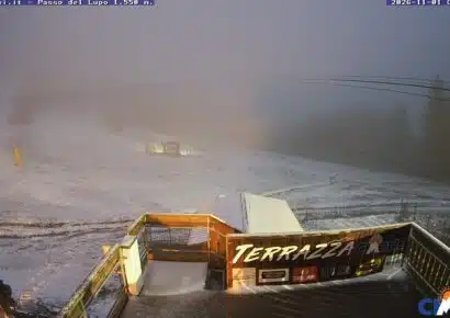
Here now are some pictures showing the snow accumulations at a few resorts:

Livigno, 10 cm

Passo dello Stelvio, deep in snow with over 1 metre on the ground, about 15 cm

Aprica at 2,000 m, yesterday.

And Aprica today with 20-30 cm of fresh snow.
The forecast for the weekend isn’t the best: mild temperatures and dry weather, but with fairly low minimums on the plains and widespread morning temperature inversions. Freezing level above 2,500 m from Saturday to Sunday. Fortunately, this situation will only last until Sunday. In fact, as early as Monday we will see a drop in temperatures, more marked in the evening.
The projections for the following days, on the other hand, are very good: from the middle of next week we will be hit by cold currents. Minimum temperatures on the plains will be around 0, with the first frosts on the upper Lombard plains. Maximum temperatures are expected to stay around 10°.
And finally, some excellent news that arrived a few days ago.
Even though it’s still early, and it’s true that forecasts beyond 15 days aren’t the greatest, I want to show you the projections for December anyway. For this month there is a real chance of finally getting a month with negative anomalies of around 1°, and I’m talking about northern Italy! According to most models, it will be a December alternating very cold, stable periods with cool or cold, very unsettled periods, with bad weather that could even be severe. This year, snow on the plains could make its appearance by New Year at the latest, in grand style. Indeed, heavy snowfall with intense cold is expected over northern Italy right around New Year, but as I said before, it’s still too early to talk about it; let’s just hope it turns out that way and that a winter like the ones we haven’t seen for a few years finally returns!


No comments yet