









There had been talk of it for a long time, but until now there was no firm evidence that Google was working on a street viewer for ski slopes. For those who don’t know, Google Street View is a service integrated into Google Maps that lets you travel along roads through 3D navigation which recreates, with real images, all the main roads (and others) in Google Maps.
Google Street View was an instant success because it lets you understand the route of a road with real-world references. To achieve this, several cars fitted with a special camera able to photograph the surrounding landscape in 360 degrees were unleashed on the cities.

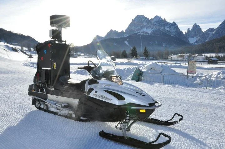
Google snowmobile with the special 360-degree camera
The idea of mapping ski slopes as well as roads had already come up with the Vancouver Winter Olympics, where Google had created a special 3D rendering of the entire competition area in Vancouver. However, the initial idea had stalled once the Olympic Games were over.
A while ago new rumours had spread about the project possibly being revived, but there was no proof. Now we have confirmation, and it comes from Alta Pusteria: in recent days Google has been mapping the slopes of the Sesto Ski Area with a snowmobile carrying the special 360° camera.
So the project has started, and soon we will be able to ski virtually on the slopes of our favourite ski areas and take a close look at the slopes of the ski areas we have not yet visited and would like to visit.


No comments yet