









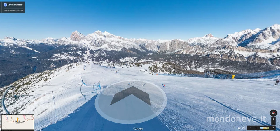

Starting today, with Google Maps you can also “navigate” along the slopes of the Cortina d’Ampezzo ski area.
A project conceived and proposed by Google Trusted Photographer Toni Bornacin—multimedia communication expert and external contributor to Google Maps—to the Cortina Turismo Consortium, which together with the Cableway Operators Consortium embraced this important opportunity.
Thanks to the virtual interactive guide, which uses Street View technology to geolocate 360° panoramic images of the ski area within the maps, all Dolomites enthusiasts can “visit” the slopes directly from their PC, smartphone, or tablet, discover their features, gather information, and get a taste of the wonderful landscapes usually enjoyed with skis—or a snowboard—on their feet.
TRY IT NOW – Google Ski Map of the Cortina d’Ampezzo Ski Area

Faloria, Cristallo, Mietres, Tofana, RaValles/Drusciè, 5 Torri, Lagazuoi, Col Gallina, Auronzo, Misurina, and San Vito di Cadore are the Ski Areas “virtualized” by Toni Bornacin in collaboration with Giuseppe Ghedina, a Google Trusted Photographer living in Cortina and a connoisseur of the Dolomites, in addition to around 10 mountain huts that immediately seized the opportunity to showcase their facilities—including their interiors—bringing themselves ever closer to the needs of Dolomites guests.
Furthermore, within a few days the cross-country ski trails of the Cortina and Tre Croci area will also be added to Google, following an initial mapping test carried out in Fiames in early February during the Cortina-Dobbiaco Granfondo.
Finally, for the summer season, the project will be completed with the mapping of over 20 hiking trails and their corresponding mountain huts.
Stefano Illing, President of Cortina Turismo, states: «Cortina proves once again capable of harnessing the tools provided by the web to showcase the territory of the Queen of the Dolomites».
Enrico Ghezze, CEO of Funivie Faloria and president of the Cortina d’Ampezzo cableway operators consortium, concluded: «It was a great team effort and it is a
wonderful satisfaction to see this project come to fruition. Moreover, we have just revamped the SkiCortina App: another way to keep guests of the Queen of the Dolomites informed».
TRY IT NOW – Google Ski Map of the Cortina d’Ampezzo Ski Area
More and more resorts on Google Maps
The slope-mapping project began with the Vancouver Olympics in Canada and has never stopped since. Google snowmobiles have been spotted time and again in various resorts, and in Italy alone some of the finest ski destinations have been virtually mapped, including Madonna di Campiglio, Cervinia, Plan de Corones, Adamello Ski, and many others.
To ski virtually on the slopes of other resorts as well, visit the page > Google Ski Maps MondoNeve


No comments yet