









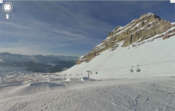
 Google Ski Maps has landed in Italy, the innovative “made in Google” system that allows you to virtually ski down the slopes of the best Italian and international ski areas. We had already talked about it in the past—first mentioning the beta tests conducted during the recent Winter Olympics in Canada, and then last year when Google’s snowmobiles were spotted on the mountains of Alpe di Siusi.
It was later reported to us that Street View-style filming had begun several years ago and had also covered other ski areas, such as the ski resort of Folgarida-Marilleva.
Unlike previous posts, we don’t want to tell you about the project itself, but rather (at last) about the online launch of this innovative service that will undoubtedly change the way ski maps are conceived.
Google Ski View arrives in Italy by publishing on-slope navigation for the ski areas of:
- Alpe di Siusi
- Kronplatz
- Madonna di Campiglio
- Folgarida Marilleva
- Madesimo
- Cervinia and Valtournenche

For now, these are the ski areas that have adopted this Street View-style system, though more could be added in the future. Italy, however, is not the only place where Google has mapped ski slopes; in fact, the project began in Canada and then expanded to other parts of the world such as Austria, Switzerland, and France, covering almost all major ski destinations like St. Moritz, the Austrian Tyrol…
How do they map the slopes in 360 degrees?
Most likely some of you have already seen Google’s cars fitted with a special camera mounted above the roof; well, for ski slopes they use snowmobiles.

Google snowmobile Alpe di Siusi
Almost all the maps were created using a special camera capable of shooting in 360 degrees; for the operator, the only task is to ride along the slopes on the snowmobile, while technology and Google’s programmers take care of the rest.
In some ski areas, however, a slightly less high-tech approach was also used. In fact, some sections of the slopes were “mapped” directly by skiers who carried a camera mounted in a backpack up and down the snow.
How do you use it?
How it works is easy to use (TRY IT NOW) and is completely identical to Google Street View. Simply click on the arrows at the bottom of the screen to move forward or backward, or double-click with your mouse on a specific point along the run to be taken automatically to that exact part of the slope.
Try it yourself!
We have created the Google Ski Maps page where you can try out all the 3D ski slope maps.
We are adding all the ski destinations that have adopted this new feature, so bookmark the link and browse through the ski areas right from your home PC!
Link: http://www.mondoneve.it/google-ski-maps/


No comments yet